Loess Plateau Watershed Rehabilitation Project
Introduction to the project:
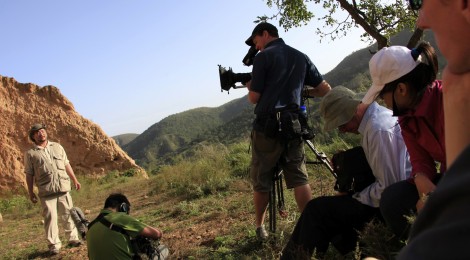
John D. Liu, Director of the EEMP, has documented the rehabilitation of the Loess Plateau since 1995, and since then has presented his findings and the images of the Loess Plateau Watershed Rehabilitation Project to over 300 audiences in China, Europe, Africa, and USA.
Where?
The Loess Plateau is approximately the size of France, encompassing 640,000 square kilometres in the upper and middle reaches of the Yellow River. It gets its name from the powdery loess soil that is its primary feature. The mineral-rich windborne sedimentary loess deposits are hundreds of meter thick in many places.
The Loess Plateau stretches over parts of 7 Chinese provinces; Qinghai, Gansu, Ningxia, Inner Mongolia, Shaanxi, Shanxi and Henan.
Why is this Project important?
Fossil remains prove that humans and their ancestors have lived here for more than 1.5 million years. This is the cradle of Chinese civilization where settled agriculture first emerged between 9,500 and 10,000 years ago. This is the place where the Han, Qin, Tang and many other Chinese dynasties flourished.
Ever since the advent of settled agriculture, the fine, powdery loess soil has eroded continuously, and in ever increasing amounts, until the plateau became one of the most eroded places on earth.
The Yellow River gets its name from this yellow silt that it carries and the constant degradation gradually changed the river as the silt raised the riverbed and made it easier for the river to flood.
Chinese history is well documented and we know that the Yellow River has flooded more than 1,500 times in recorded history. The Yellow River became known as “China’s Sorrow” because of all the suffering caused by the floods.
Projects on the ground:
It takes an overarching and ambitious vision to believe that what was destroyed over 10,000 years could be restored; yet a little over a decade ago, the Chinese government decided to do just that.
1. Planning:
Over 3 years, Chinese planners from the Ministry of Water Resources and international planners from the World Bank worked together with experts in hydrology, soil dynamics, forestry, agriculture and economics, to design a workable project plan. The team divided their work into 2 areas: economic and social well being of the people, and ecologic health of the environment.
2. Policy:
From the planning process, a number of important decisions emerged.
- Ban tree cutting – a law was instituted banning indiscriminate tree cutting throughout China following the devastating floods of 1998.
- Ban planting on steep slopes – this reversed centuries of unsustainable agricultural practice among poor farmers trying to plant crops on the sides of hills and gullies.
- Ban free-range grazing of livestock – this policy ended the practice of allowing great numbers of goats and sheep to range freely to denude the natural vegetation.
- Land tenure – clear policies on land tenure were established to delineate the rights and responsibilities of farmers for each terraced field and each tree planting area in the project.
- Differentiate and designate ecological and economic land, restricting production to suitable land and releasing marginal land to return natural vegetative cover. This was based on an understanding that the ecological function was vastly more valuable than the production in the marginal lands. This understanding if applied on a planetary scale would help us build a sustainable society.
- Integrated watershed management practices which created water-harvesting structures, ensured continuous vegetative cover by release of marginal lands to nature and including large-scale reforestation and grasslands regeneration and the use of agro-forestry methods.
3. Participation:
Early in the rehabilitation process it was critical to engage the local people to understand and participate in the rehabilitation efforts, and to convince them of the value of rehabilitation work.
Background
Cycle of Poverty and Ecological Destruction – Research shows that in the Loess Plateau, what was once a pristine nurturing ecosystem, was fundamentally altered by human impact, leading to almost total ecological devastation over a vast area.
People living on the plateau experienced a gradual social and economic decline. Each passing generation did not worry too much that the environment was in decline and what happened took place over such a long time and on such a scale that few people were aware that those changes were taking place.
Cutting the forests and preparing the earth to plant crops did several things. First, it exposed the fragile loess soil to the wind and rain, causing the erosion that led to the many gullies that are now so evident in the plateau. This exacerbated the tendency to flooding during the rainy season, followed by drought and famine the rest of the year.
Removing the vegetation cover also devastated a microbiological layer near the soil surface made up of decaying plant litter. This destroyed the cycle of natural fertility of the region and disrupted the ability of water to be absorbed into the soil during rainfall.
Gradually wild plants and animals disappeared. People planted crops on steeper and steeper sides of the gullies and took their sheep and goats further to eat grasses and bushes hoping to eke out a living. However, with their own activities further degrading the natural systems, the people became mired in poverty.
Watch Lessons of the Loess Plateau here.


